© Adam Jeżewski | The Vistula river
Capturing beauty in an era of ecological crisis places the photographer in a challenging position. When someone photographs a drought-exposed riverbed, the abstract shapes resulting from glacial retreat, or the geometric patterns of a mountain-turned-mine, the image can have very different meanings based on how it is framed.
This selection of six photographers, each approaching aerial imagery from different disciplines and intentions, collectively explores the landscape that this perspective reveals. Their work covers industrial wastelands in Brazil, tidal wetlands in the Camargue, the drought-affected bed of the Vistula, and abstract compositions created from ice, sediment, and seasonal colours. Together, they raise a compelling question that the aerial perspective uniquely invites: what does it mean to see the earth from above, and how does this viewpoint challenge us?
The six bodies of work presented here are united not by style or subject matter but by a common dedication to the aerial perspective as a way of seeing that reveals knowledge not accessible from the ground. This knowledge can be aesthetic — like discovering painterly forms in tidal zones — ecological — such as documenting a river at historic low water or a mountain altered by extraction — or philosophical — recognizing that beauty and destruction can coexist within a single frame. The elevated view is essential to this approach. The photographers included here share this intent, even when their subjects and methods differ greatly.
Hidden rhythm of the earth
The aerial perspective uniquely alters the sense of scale. For each subject, altitude acts as the tool that renders the image feasible. From a high vantage point, a motorway interchange and a forest can appear on the same visual plane; the difference between engineered and natural elements merges into lines and shapes.
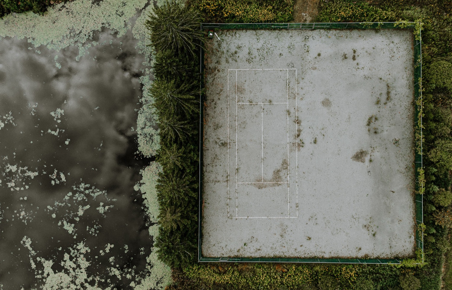
Guillaume Gorini, flying a drone over Montreal's landscapes, has developed a practice focused on this very dissolution. Roads cut through monochrome fields, weathered tennis courts give way to marshes, and a lone red fishing hut stands out among the fractal patterns of a frozen lake. The horizon disappears, along with the usual cues that help us find our place within a scene. What remains is pattern—the earth's concealed rhythm, as Gorini describes it, invisible from below.
Oliver Heinl, a Bavarian architectural photographer who takes his drone over open landscapes, describes the aerial perspective as an entry into an abstract universe he feels familiar with, yet only becomes fully visible from above. Heinl discovers wonders, forms, and a sense of lightness in the abstract world beneath his drone.
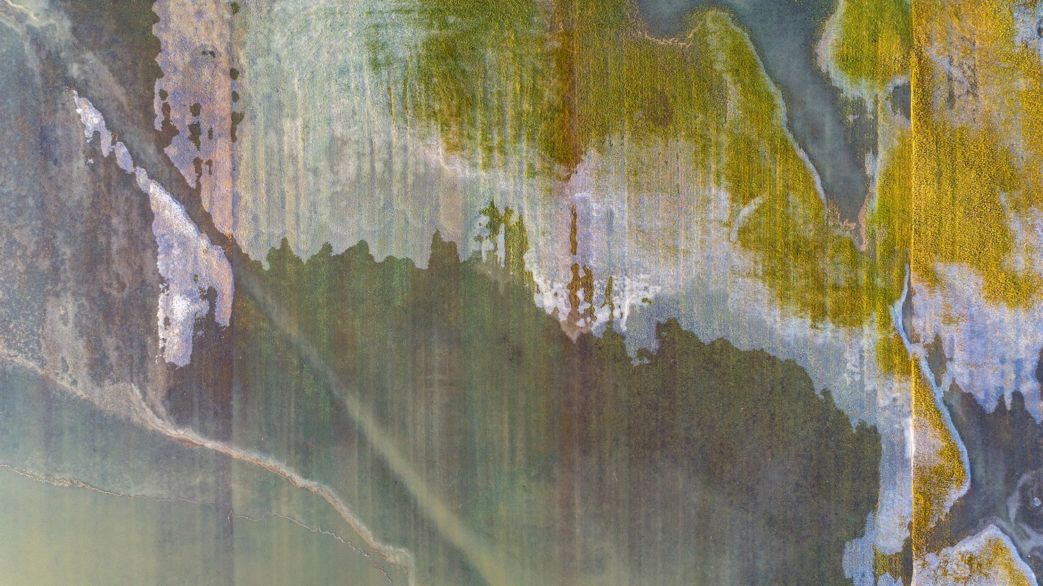
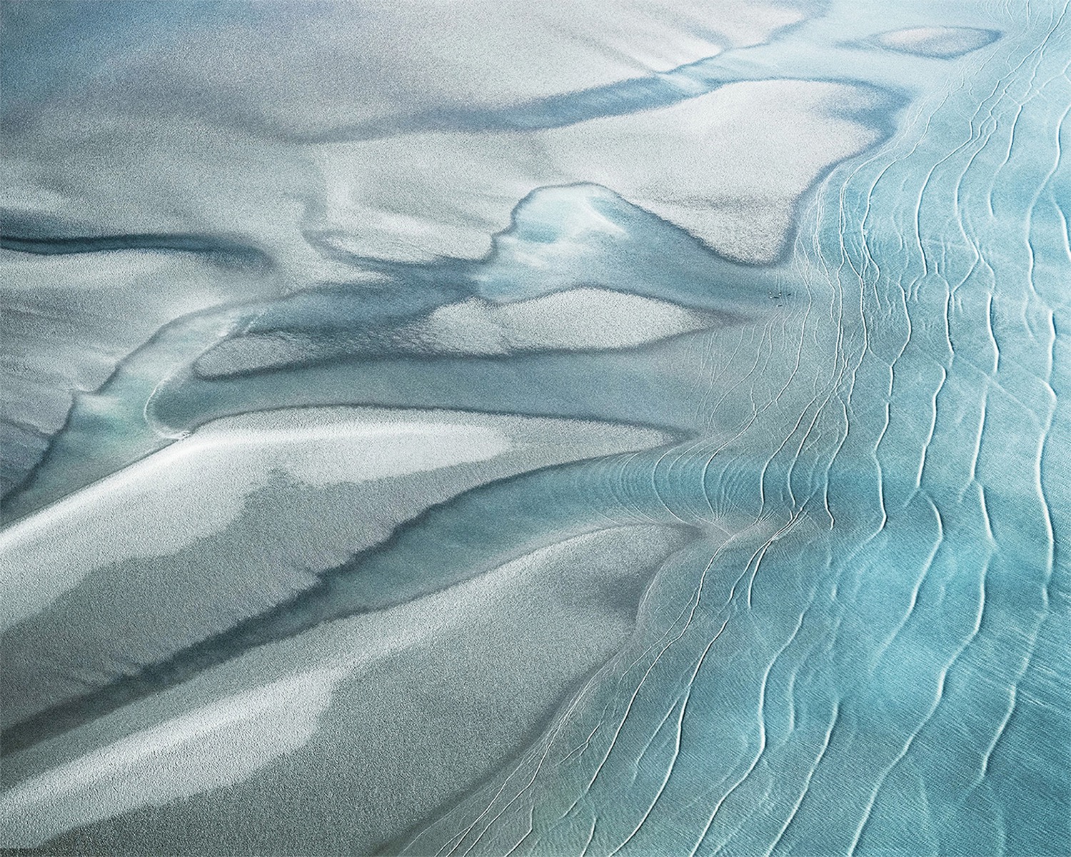
Wladyslaw Gustynowicz notes a similar phenomenon in nature: ice, water, vegetation, and sediment creating shapes that resemble animals, celestial bodies, and painterly marks. He perceives beauty in these natural formations and interprets them as proof of a creative process: the earth itself as an artist, with natural forces as the true sculptors of form. Gustynowicz invites viewers to find familiar shapes within random arrangements, encouraging a re-examination of the line separating landscape from abstraction.
Abstract Waters
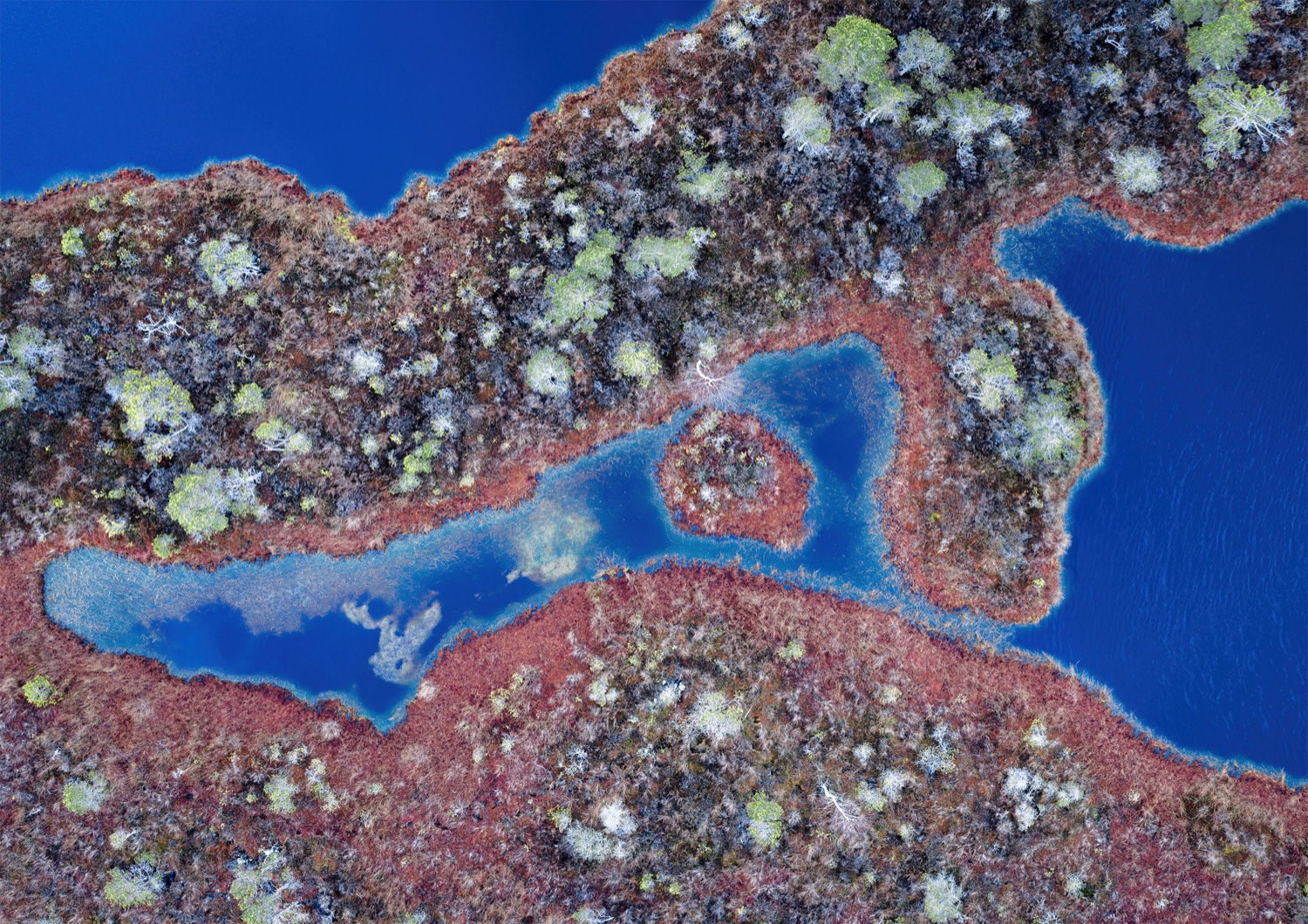
The tension between aerial photography as a documentary tool and as a form of abstraction is the most productive aspect of the genre. Brigitte Bourger, capturing images of the Camargue wetlands and Western Australia's coastlines, adopts a notably lyrical approach, with marshes, salt flats, and tidal zones forming fluid compositions of light and texture. Her framing emphasizes aesthetics, and her goal is poetic. These photographs serve as records of particular places and ecological states. Within a single frame, abstraction intertwines with documentation. Bourger's work encourages viewers to perceive living paintings in wetlands and tidal environments.
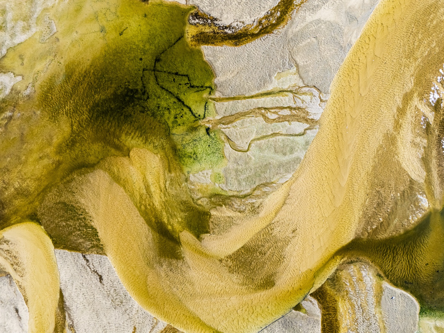
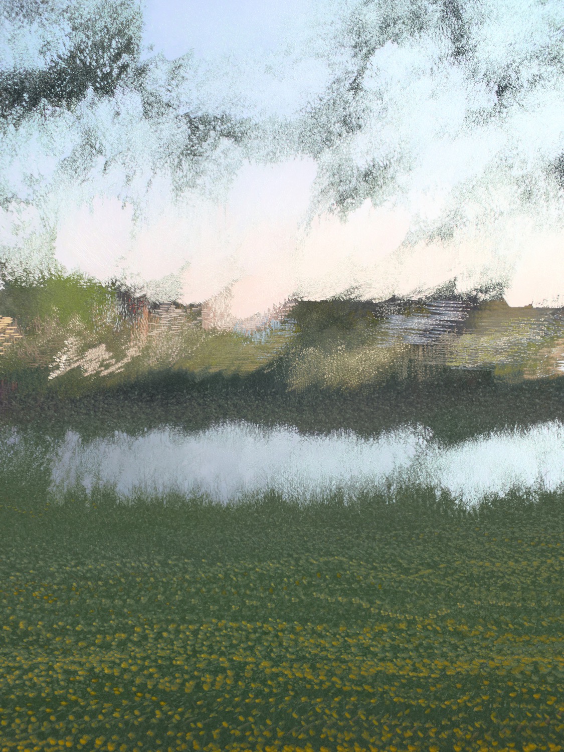
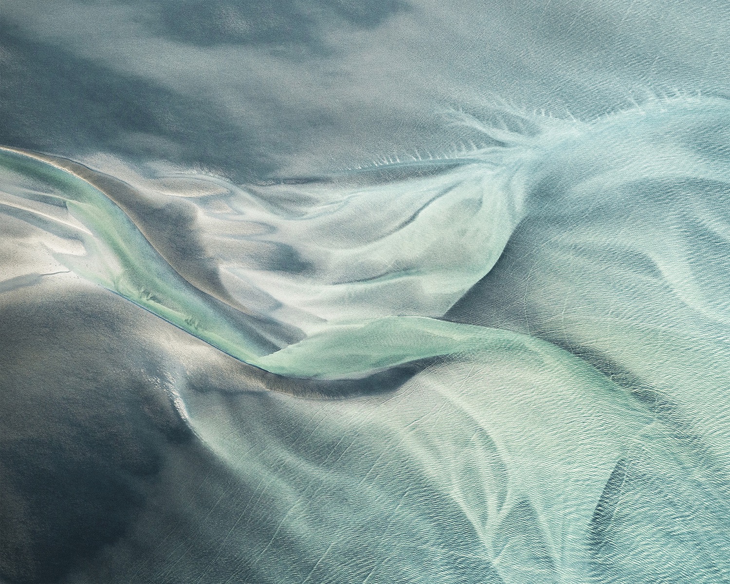
Adam Jeżewski captures the Vistula River at its historic low-water mark of six centimeters in summer 2025, observing similarities in the exposed sandbanks and stranded ponds caused by drought. For these photographers, aerial view is essential for creating their images. The exposed sandbanks, stranded ponds, and moving vegetation are distinctly painterly — Jeżewski agrees. However, the aerial abstractions also document an ongoing disaster.
Aesthetic Documentary
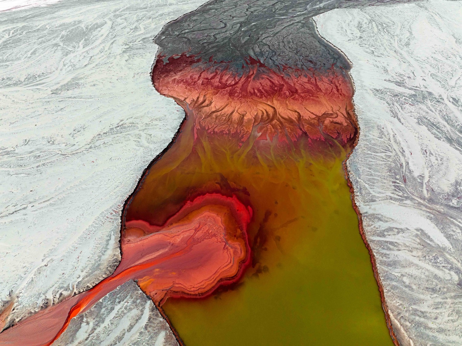
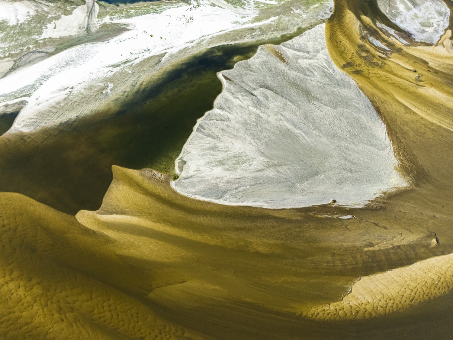
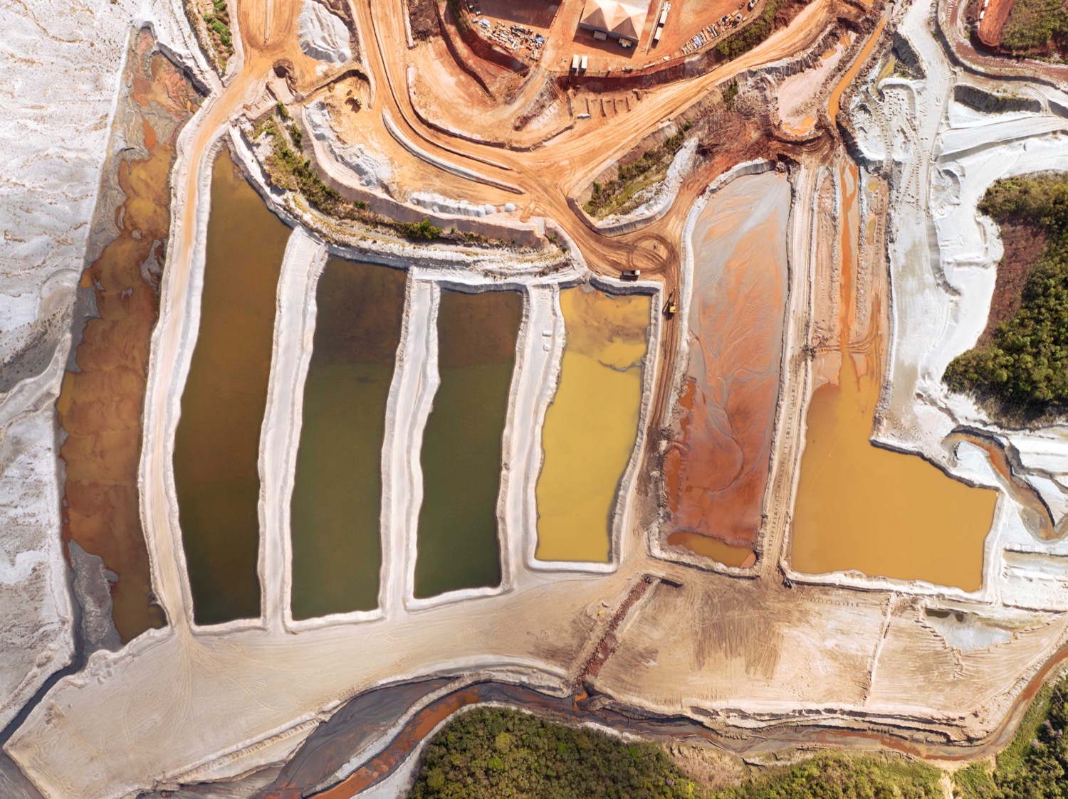
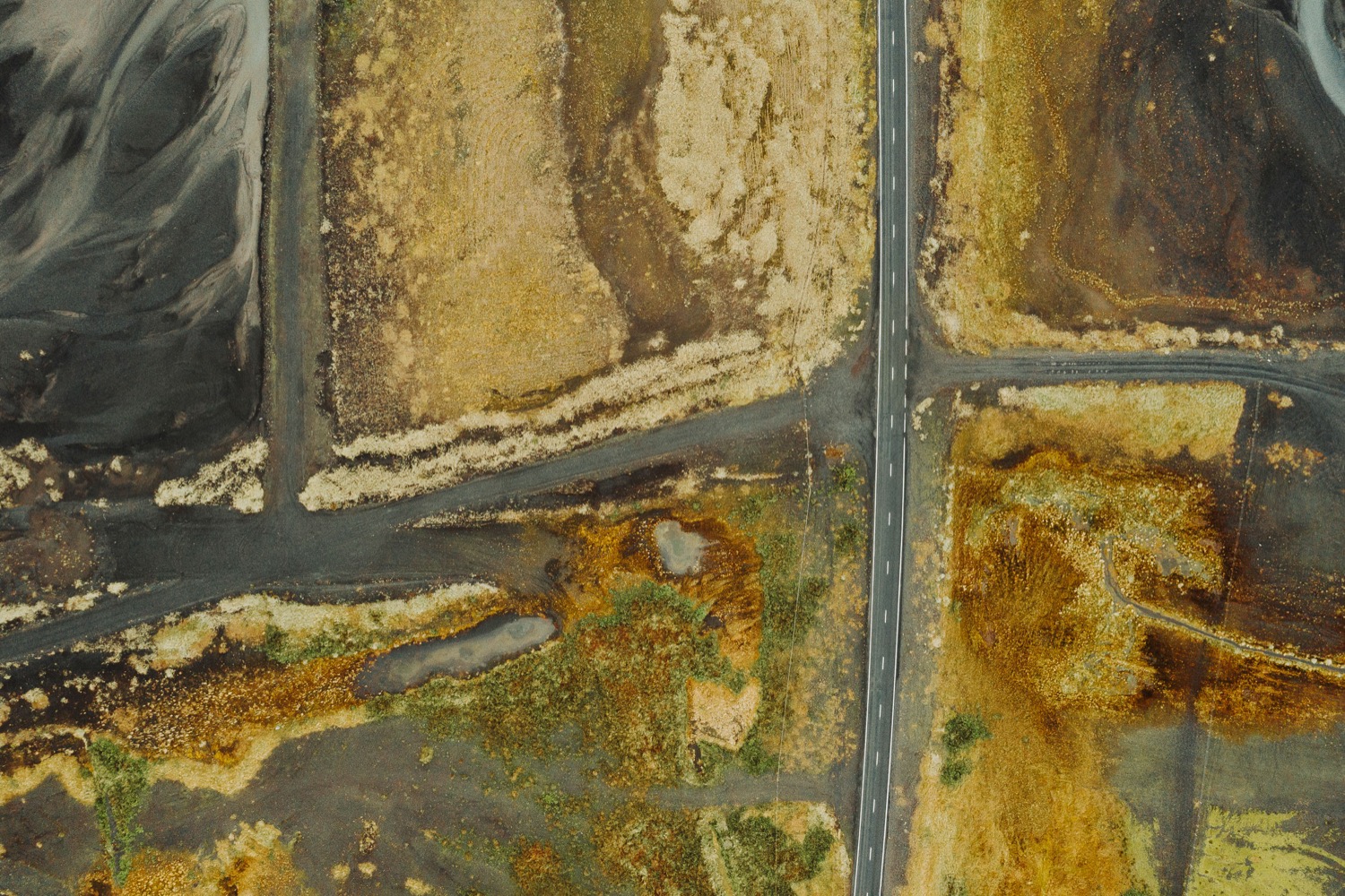
Michael Naify captures aerial photographs of iron mines and steel plants in Minas Gerais, Brazil—a region whose name means 'General Mines.' His work explicitly highlights the tension inherent in this landscape. The images feature pools of toxic orange water in excavated craters, reminiscent of vibrant pigment on canvas. Green erosion netting drapes over exposed rock formations, resembling marbled paper or veined minerals. Conveyor systems cut across the frame like ruled lines on a drawing. These images blend aesthetics with documentary purpose, emphasizing that the two are inseparable—and that this duality is intentional. Naify suggests that the aerial perspective creates a perceptual distance similar to that which enables ongoing extraction at this scale.
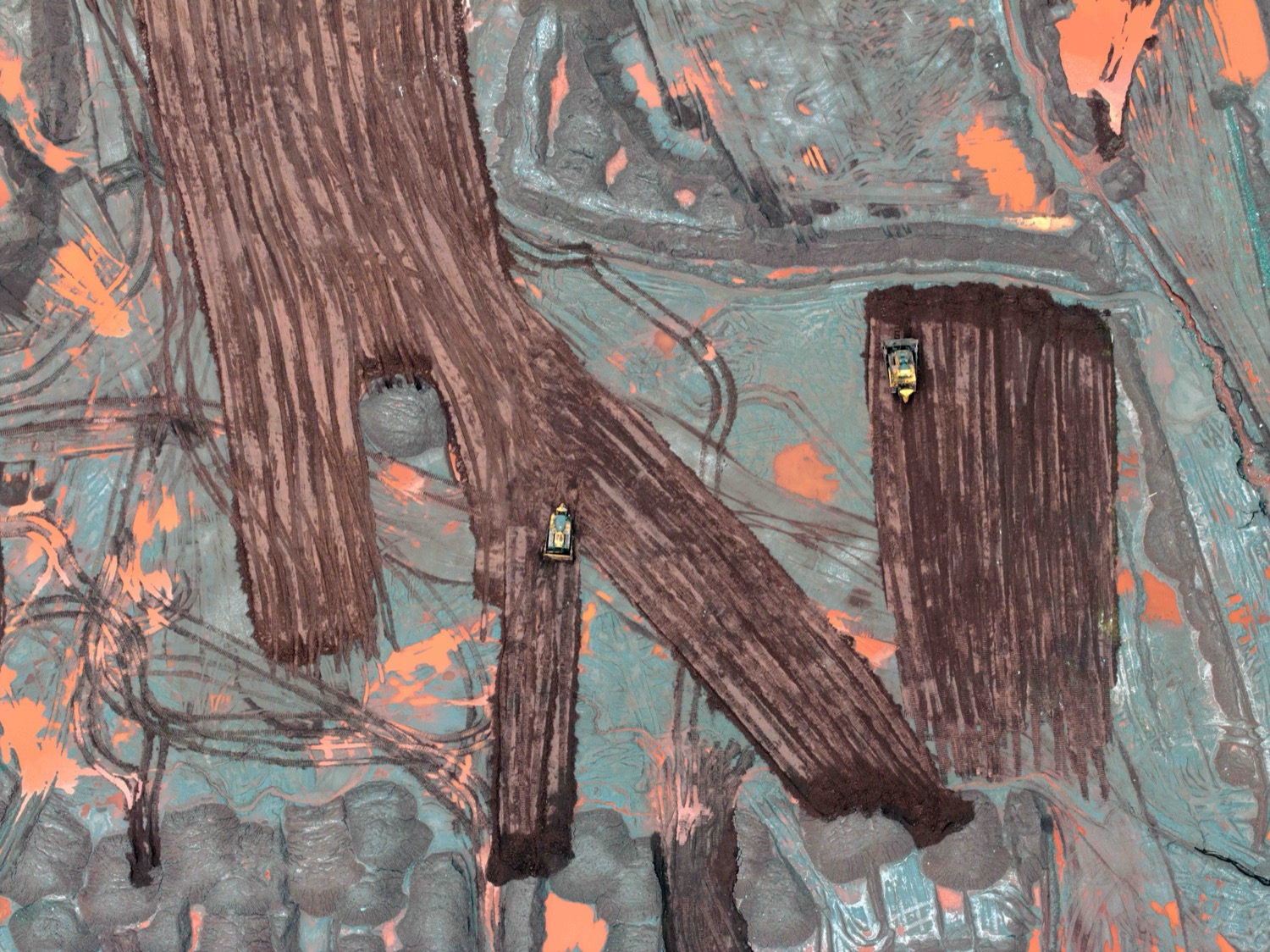
The allure of the composition involves the viewer in what it depicts. In aerial photography of damaged landscapes, aesthetic pleasure mirrors the process that caused the damage, transforming the living landscape into a visually appealing form. It shows how wounds are created.
Aesthetic pleasure can serve as both an alarm and an anaesthetic. The most significant aerial work maintains this ambiguity, not settling the tension. These photographs capture its current phase: land reshaped, waterways modified, atmosphere transformed. The camera gazes downward at these changes, and the earth appears unrecognizable in return.
“The camera looks down at what we have done to the earth, and the earth looks back unrecognisable, territory suspended between landscape and wound, geology and ruin.” - Michael Naify

Modern Drone Photography
Throughout most of photography's history, achieving an aerial view involved using aircraft, obtaining permissions, incurring high costs, and requiring specialized equipment. The advent of consumer drones revolutionized this process. Several photographers in this collection primarily use drones—Gorini frequently employs his to document landscapes while traveling, and Heinl uses his to create art projects in collaboration with nature. These practitioners come from diverse fields such as architecture, documentary, fine art, and science, all discovering in the elevated perspective a new dimension that their previous work could not capture.
The increased availability of aerial imagery due to drone technology has shifted audience expectations and challenged photographers to differentiate their work. Overhead shots are now common, but what still sets apart exceptional work is the purpose behind using such angles: intentionally employing altitude not as a mere compositional element but as a means of exploring the Earth's nature, its history, and its potential future.
.svg)
.svg)
.svg)

Capturing beauty in an era of ecological crisis places the photographer in a challenging position. When someone photographs a drought-exposed riverbed, the abstract shapes resulting from glacial retreat, or the geometric patterns of a mountain-turned-mine, the image can have very different meanings based on how it is framed.
This selection of six photographers, each approaching aerial imagery from different disciplines and intentions, collectively explores the landscape that this perspective reveals. Their work covers industrial wastelands in Brazil, tidal wetlands in the Camargue, the drought-affected bed of the Vistula, and abstract compositions created from ice, sediment, and seasonal colours. Together, they raise a compelling question that the aerial perspective uniquely invites: what does it mean to see the earth from above, and how does this viewpoint challenge us?
The six bodies of work presented here are united not by style or subject matter but by a common dedication to the aerial perspective as a way of seeing that reveals knowledge not accessible from the ground. This knowledge can be aesthetic — like discovering painterly forms in tidal zones — ecological — such as documenting a river at historic low water or a mountain altered by extraction — or philosophical — recognizing that beauty and destruction can coexist within a single frame. The elevated view is essential to this approach. The photographers included here share this intent, even when their subjects and methods differ greatly.
Hidden rhythm of the earth
The aerial perspective uniquely alters the sense of scale. For each subject, altitude acts as the tool that renders the image feasible. From a high vantage point, a motorway interchange and a forest can appear on the same visual plane; the difference between engineered and natural elements merges into lines and shapes.
Guillaume Gorini, flying a drone over Montreal's landscapes, has developed a practice focused on this very dissolution. Roads cut through monochrome fields, weathered tennis courts give way to marshes, and a lone red fishing hut stands out among the fractal patterns of a frozen lake. The horizon disappears, along with the usual cues that help us find our place within a scene. What remains is pattern—the earth's concealed rhythm, as Gorini describes it, invisible from below.
Oliver Heinl, a Bavarian architectural photographer who takes his drone over open landscapes, describes the aerial perspective as an entry into an abstract universe he feels familiar with, yet only becomes fully visible from above. Heinl discovers wonders, forms, and a sense of lightness in the abstract world beneath his drone.
Wladyslaw Gustynowicz notes a similar phenomenon in nature: ice, water, vegetation, and sediment creating shapes that resemble animals, celestial bodies, and painterly marks. He perceives beauty in these natural formations and interprets them as proof of a creative process: the earth itself as an artist, with natural forces as the true sculptors of form. Gustynowicz invites viewers to find familiar shapes within random arrangements, encouraging a re-examination of the line separating landscape from abstraction.
Abstract Waters
The tension between aerial photography as a documentary tool and as a form of abstraction is the most productive aspect of the genre. Brigitte Bourger, capturing images of the Camargue wetlands and Western Australia's coastlines, adopts a notably lyrical approach, with marshes, salt flats, and tidal zones forming fluid compositions of light and texture. Her framing emphasizes aesthetics, and her goal is poetic. These photographs serve as records of particular places and ecological states. Within a single frame, abstraction intertwines with documentation. Bourger's work encourages viewers to perceive living paintings in wetlands and tidal environments.
Adam Jeżewski captures the Vistula River at its historic low-water mark of six centimeters in summer 2025, observing similarities in the exposed sandbanks and stranded ponds caused by drought. For these photographers, aerial view is essential for creating their images. The exposed sandbanks, stranded ponds, and moving vegetation are distinctly painterly — Jeżewski agrees. However, the aerial abstractions also document an ongoing disaster.
Aesthetic Documentary
Michael Naify captures aerial photographs of iron mines and steel plants in Minas Gerais, Brazil—a region whose name means 'General Mines.' His work explicitly highlights the tension inherent in this landscape. The images feature pools of toxic orange water in excavated craters, reminiscent of vibrant pigment on canvas. Green erosion netting drapes over exposed rock formations, resembling marbled paper or veined minerals. Conveyor systems cut across the frame like ruled lines on a drawing. These images blend aesthetics with documentary purpose, emphasizing that the two are inseparable—and that this duality is intentional. Naify suggests that the aerial perspective creates a perceptual distance similar to that which enables ongoing extraction at this scale.
The allure of the composition involves the viewer in what it depicts. In aerial photography of damaged landscapes, aesthetic pleasure mirrors the process that caused the damage, transforming the living landscape into a visually appealing form. It shows how wounds are created.
Aesthetic pleasure can serve as both an alarm and an anaesthetic. The most significant aerial work maintains this ambiguity, not settling the tension. These photographs capture its current phase: land reshaped, waterways modified, atmosphere transformed. The camera gazes downward at these changes, and the earth appears unrecognizable in return.
“The camera looks down at what we have done to the earth, and the earth looks back unrecognisable, territory suspended between landscape and wound, geology and ruin.” - Michael Naify
Modern Drone Photography
Throughout most of photography's history, achieving an aerial view involved using aircraft, obtaining permissions, incurring high costs, and requiring specialized equipment. The advent of consumer drones revolutionized this process. Several photographers in this collection primarily use drones—Gorini frequently employs his to document landscapes while traveling, and Heinl uses his to create art projects in collaboration with nature. These practitioners come from diverse fields such as architecture, documentary, fine art, and science, all discovering in the elevated perspective a new dimension that their previous work could not capture.
The increased availability of aerial imagery due to drone technology has shifted audience expectations and challenged photographers to differentiate their work. Overhead shots are now common, but what still sets apart exceptional work is the purpose behind using such angles: intentionally employing altitude not as a mere compositional element but as a means of exploring the Earth's nature, its history, and its potential future.